The trail
CSM Trail Descriptions - 2026
The trail maps continue to evolve as we move closer to the event. Look for updates, including elevation profiles, before the event.
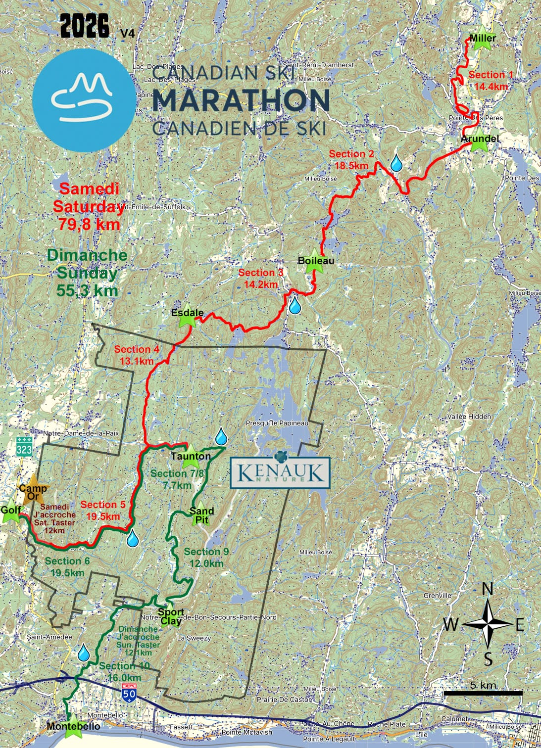
Saturday February 7th, 2026 – Northern Trail (79.8 KM)
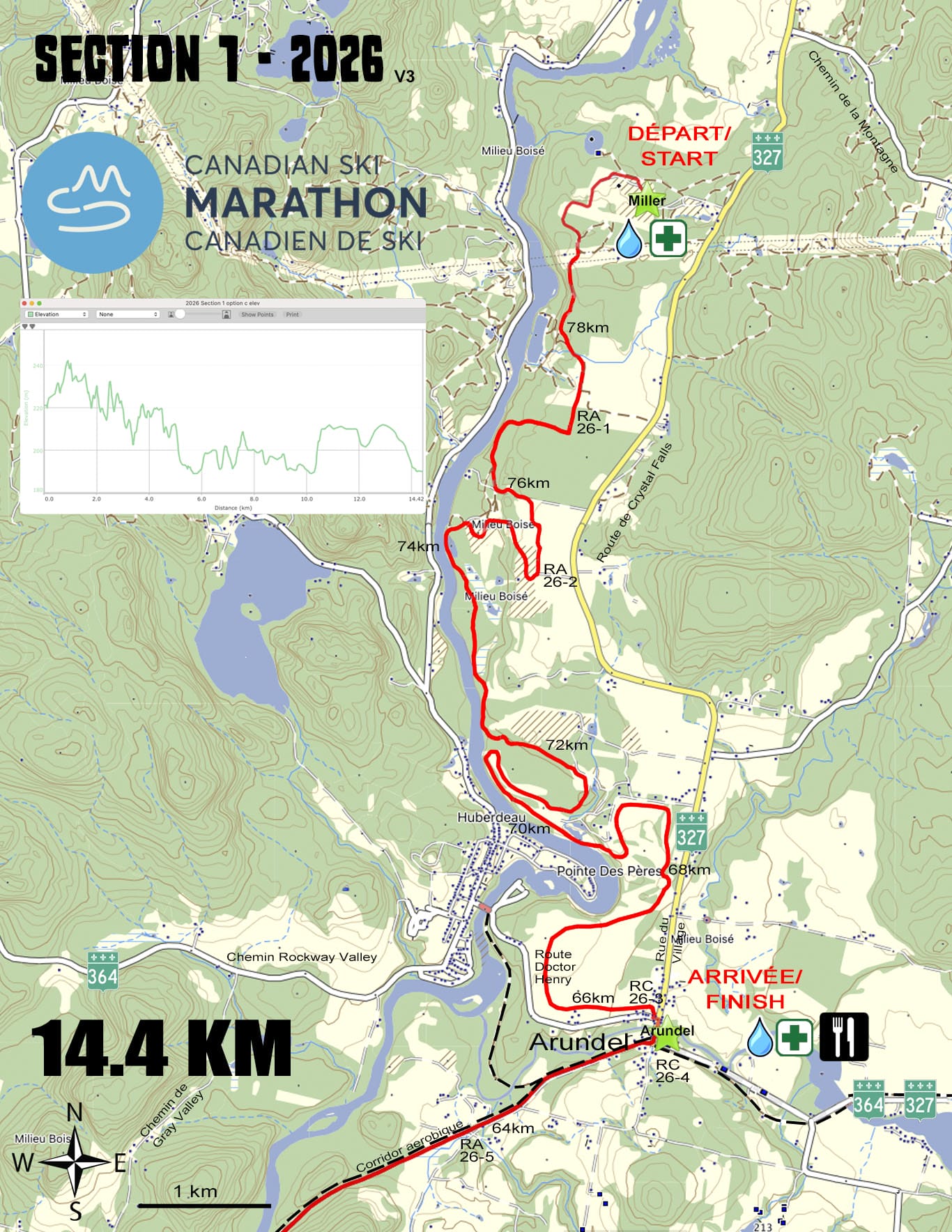
Section 1 – 14.4 km – Easy
The trail has an interesting start in a large sand pit north of the town of Arundel. It passes through varied terrain including forests, open fields, another sand pit, and a pine tree farm before entering the Arundel Golf and Country Club. There are beautiful views of the Rouge River along the way. A portion of Section 1 uses the Sentiers Loisir Arundel trail network and part uses the Arundel Golf Club trails. Thank you for your valuable collaboration. The trail finishes through a corn field as it enters the town of Arundel, where skiers remove their skis and walk one block in town to the check point at the town hall. (225m ascent, 260m descent)
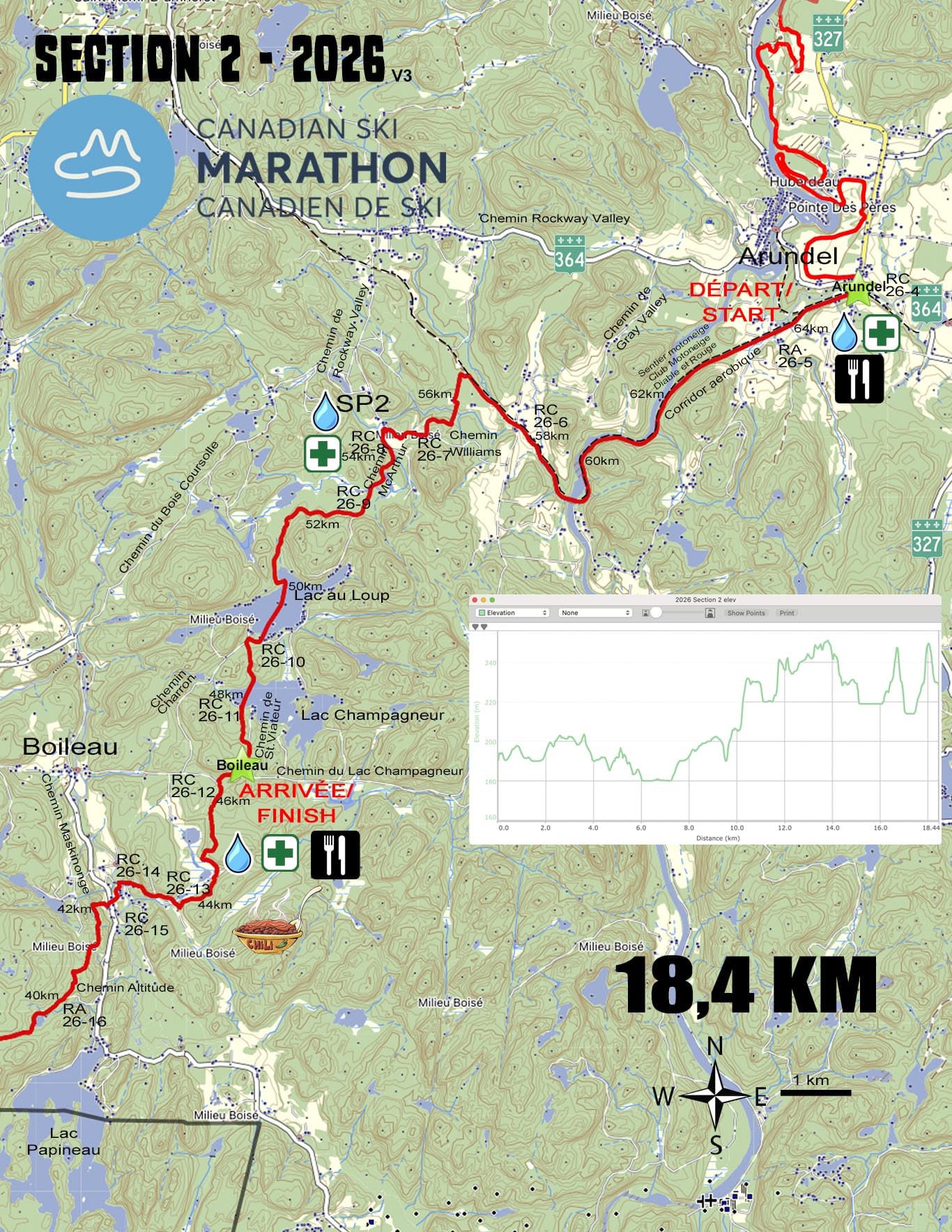
Section 2 – 18.5 km – Easy to Intermediate
The trail starts for several kilometers on a gentle downhill using the Aerobic Corridor, which is the former railway track from St Sauveur to Amherst, and passes over a long trestle bridge over the Rouge River before entering the scenic Gray Valley. It then turns through a forest, follows a cottage road, then crosses Lac au Loup and Lac Champagneur. It finally descends a cottage road before entering the checkpoint east of the town of Boileau. (260m ascent, 220m descent)
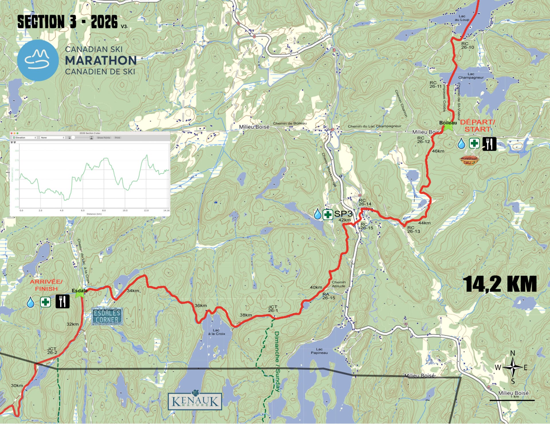
Section 3 – 14.2 km -Difficult
The trail continues through varied wooded countryside, passes along side of an open wetland then descends a hill and crosses over the Maskinongé River south of Boileau. It passes through a farm that has been used previously as a checkpoint and continues through hilly terrain toward Lac à la Croix. This year, skiers turn west on a well-known trail, which includes a significant downhill to the shore of the lake and a climb back up, ending at the Esdale’s Corner checkpoint. (370m ascent, 345m descent)
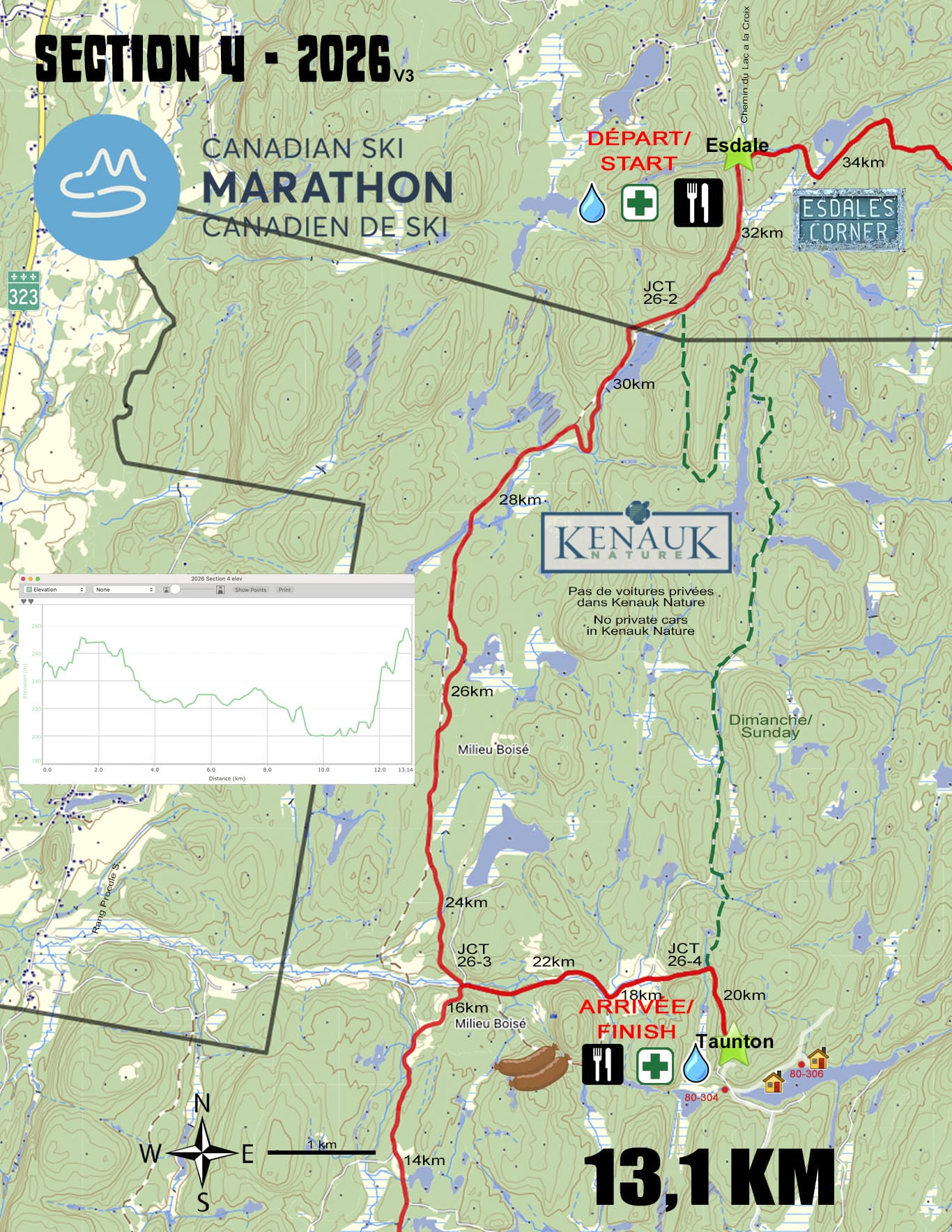
Section 4 – 13.1 km – Intermediate
The trail starts with a 2km gentle climb from Esdale’s Corner until it enters Kenauk Nature at Lac Wilson. Then it follows the historic Bourassa Road for 7.5km, which was the main horse and buggy road from Montebello to St-Jovite during the 1800’s and later became a favorite ski route of the legendary Jack Rabbit Johannsen. The trail then turns east, goes around the side of Montagne du Loup and climbs up to the checkpoint near Lac Taunton. (190m ascent, 170m descent)
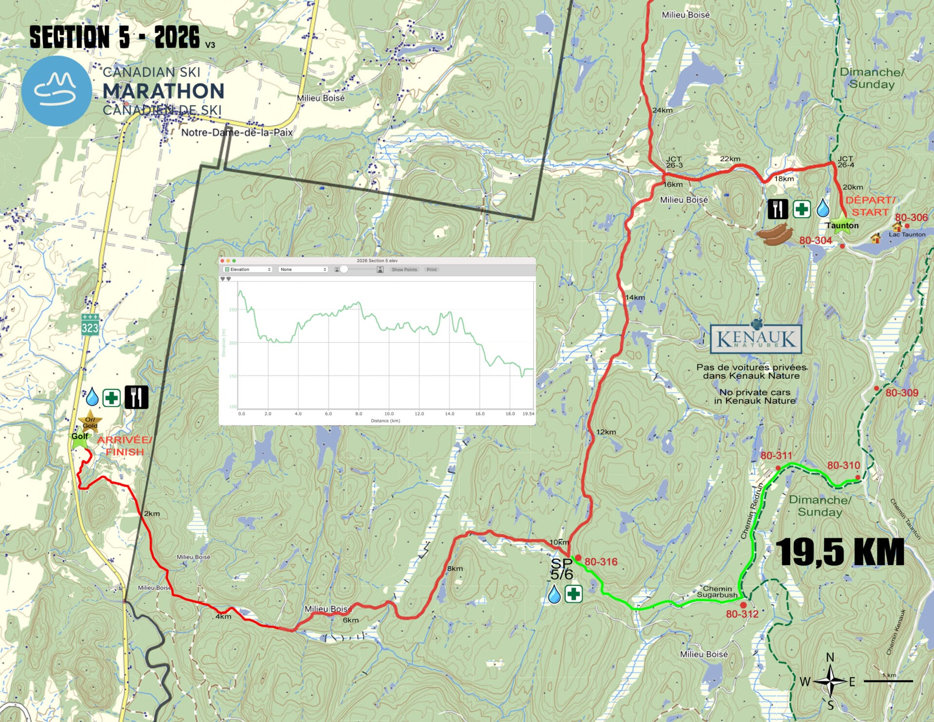
Section 5 – 19.5 km - Intermediate
Skiers leave the Taunton checkpoint and re-trace their route back to the Bourassa Road, which they follow south for 6km along easy terrain to a safety point. Then the trail turns west on Sugarbush Road for 6.5km. From there a new trail has just been built that follows the base of a long high escarpment until it enters an open fairway of the Golf Héritage golf course. It finishes with a descent to bridge across a stream and the final climb up the first fairway to the finish line. (400m ascent, 510m descent)
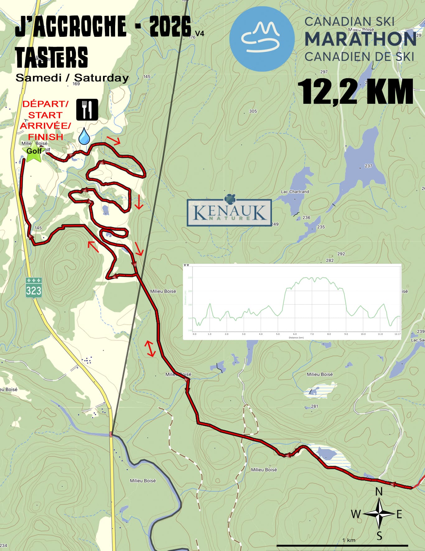
Taster Section – 12.2km - Easy to Intermediate
The Tasters have their own trail on Saturday as the last section of the main trail is longer and more difficult than many would want. Skiers start at Golf Héritage checkpoint in Notre-Dame de la Paix, which is also the finish line. The trail follows the established is trails around the golf course, meandering in and out of the forest and fairways. At one point, it joins the regular Marathon Section 5 trail and skis it in reverse for about 2k, before turning around and returning to the golf course. Skiers continue on the golf course trails and cross under the finish arch with all the other skiers. (250m ascent, 250m descent)
Sunday, February 8th, 2026 – Montebello Region (55.3 km)
Section 6 – 19.5 km – Intermediate
The trail starts at the Golf Héritage golf course with a steep descent on the first fairway then passes through a wooded river valley and starts a long climb, gaining 100m, into Kenauk Nature. It follows the Sugarbush Road with its many turns and hills, then heads north on the historic Bourassa Road, which was the main horse and buggy road from Montebello to St Jovite during the 1800’s and later became a favorite ski route of the legendary Jack Rabbit Johannsen. The first kilometer is climbing, then there is a reward with 5km of downhill, but it finishes with a half kilometer climb to the checkpoint near Lac Taunton. There is a safety point halfway along the section with limited water, so bring snacks and water. (400m ascent, 510m descent)
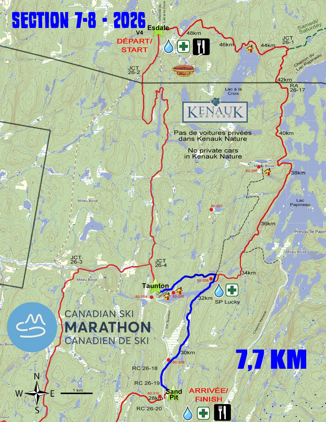
Section 9 – 12.0 km – Intermediate
The trail continues on summer roads through the forest of the Kenauk Nature. At the halfway point, the trail leaves the roads and uses the rugged Balsam trail with lots of hills designed to challenge the skier. The last 4km is all downhill, including a descent of 100m over 1.5km. It finishes in the sheltered opening of Kenauk’s Sporting Clay site, the same location as CP5 of the eastern CSM trail. (195m ascent, 250m descent)
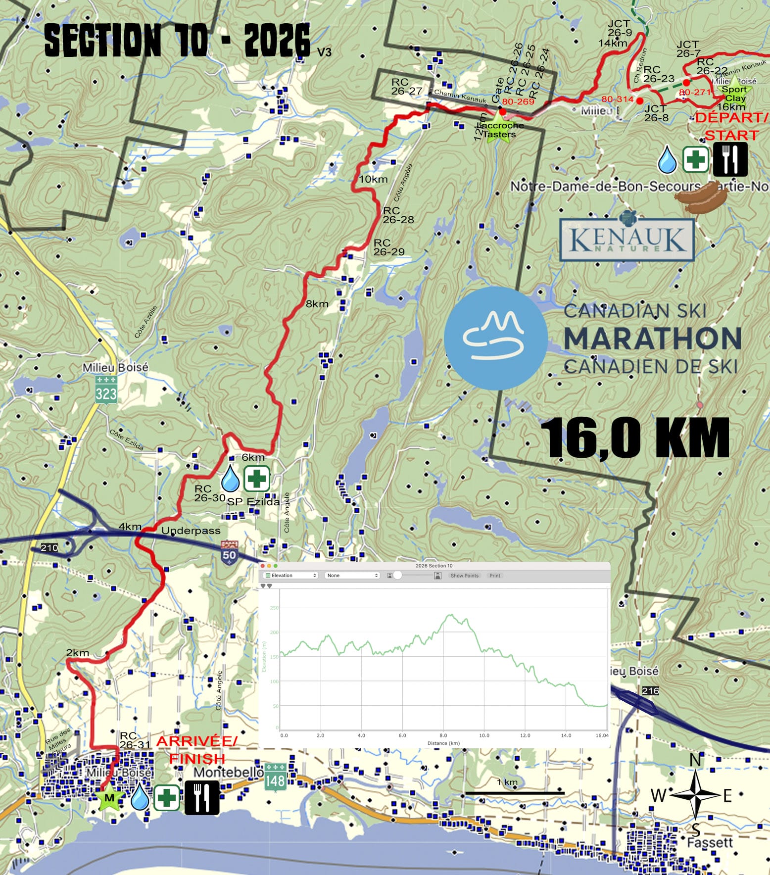
Section 10 – 16.0 km – Intermediate
(Tasters 12.1 km)
The final section follows the tradition CSM eastern trail, departing the Kenauk Nature reserve and climbing gradually for 8km through the forest. The second half is a gradual downhill through the forest, crossing under the Autoroute, and continuing down through fields to the beautiful Montebello finish line. (360m ascent, 470m descent)
Tasters who feel that the last section of the day (Section 10) is too long and difficult have the option of starting further down the trail to reduce length and hills. The trail starts at the Kenauk Nature welcome building and follows the same path as the other skiers to the finish line in Montebello. (250m ascent, 360m descent)
